
Information for Mariners
Our patch
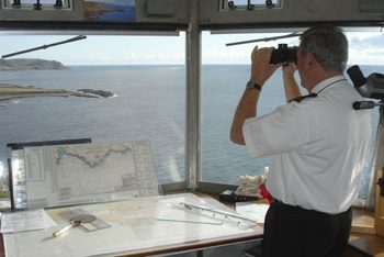
The Prawle Point Lookout* has a 240° arc of visibility over the sea off the southern tip of Devon from Peartree Point in the east to Bolt Head in the west. This includes the entrance to the attractive and popular Salcombe harbour.
On a clear day the hard horizon is just over 16 nautical miles distant. Thus we watch over 500 square nautical miles of sea.
Local hazards within sight of the Lookout are overfalls and tide races off Start Point, Prawle Point and Bolt Head. Salcombe Bar.
* at 50°12.2′ N, 003°43.2′ W (50.202908, -3.720267)

Watching out for your safety
If you go to sea within the area covered by our watchstation you have the reassurance that, if we can identify your vessel, it will be logged. Help boost your safety by having your boat name clearly readable and for a sailing vessel have a sail number showing.
A team of around 60 trained and qualified volunteer watchkeepers share daylight watches operating every day of the year. The station is equipped with telescopes, radar, radio and telephone as well as up to date charts. In the event of an emergency, we act as the eyes of the Coastguard and update them as to the correct position of the casualty and what is happening on scene.
Since 2000 Prawle Point NCI has been recognized by the Maritime and Coastguard Agency (MCA) as having “Declared Facility Status” which means we are an integral part of the national Search and Rescue structure.
We have good working relationships with Kingsbridge Coastguard Rescue Team and Salcombe RNLI.
Other NCI stations
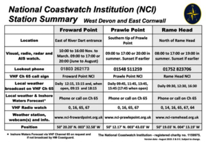
We are flanked by stations at Rame Head and Froward Point. For information about these stations as well as our own, please download our station summary card:
This card is also available from the Lookout when it is open and from our stand at the events we attend. For information about other National Coastwatch stations, visit www.nci.org.uk.
Sailing from Salcombe
| Port | Approximate passage distance (nM) | Aproximate time difference of HW from Salcombe (min.) |
| Dartmouth | 15 | +22 |
| Exmouth | 34 (approaches) | +35 |
| Falmouth | 50 | -35 |
| Fowey | 35 | -17 |
| Penzance | 76 | -57 |
| Plymouth | 18 (breakwater) | -05 (Devonport) |
| River Yealm | 16 | -01 |
| St. Mary’s (Scilly) | 101 | -55 |
| St. Peter Port (Guernsey) | 78 | +40 |
| Torquay | 24 | +30 |
How we can help
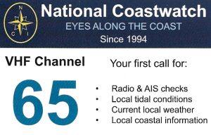
Hail “Prawle Point NCI” on VHF Channel 65 (not 16) or phone 01548 511259 to speak to one of our watchkeepers.
They can give you the current weather at Prawle Point and will have the current Inshore Waters Forecast, gale and strong wind warnings available
We broadcast the current local weather and sea conditions on Channel 65 every day at 0945, 1145, 1345, 1545 and, in the summer, at 1745.
We can also provide radio and AIS checks. Indeed, HM Coastguard ask mariners to use NCI for radio checks, particularly in the summer when they are busy. If you do not know which NCI station is nearest, just hail “NCI” and the closest station(s) should respond.

Maritime Safety Information
Falmouth Coastguard broadcasts the latest Gale Warnings and Inshore Waters Forecast every day at 0110, 0410, 0710, 1010, 1310, 1610, 1910, and 2210 local time. Announcement is made on VHF Channel 16 and off Prawle Point the MSI broadcast is then heard on Channel 62 or 64.
Directory
| Hail/Call | VHF channel | Telephone |
| Prawle Point NCI | 65 | 01548 511259 |
| Salcombe Harbour | 14 | 01548 843791 |
| Salcombe Harbour (emergency out of hours) | 01803 867034 | |
| Salcombe Water Taxi | 12 | 07807 643879 |
Operational capability
| Radio callsign | Prawle Point NCI |
| Hours | Every day from 09:00 until 17:00 in the winter or 20:00 in the summer (local time) or sunset if earlier. See our Home page for today’s hours. |
| Visual watch | Yes |
| Radar watch | Yes |
| AIS watch | Yes |
| DSC Watch | No |
| VHF listening watch | Channels 16, 65, 67 & 0 |
| VHF channels in use | Call direct (not via 16): 65 If authorised by HM Coastguard: 0 |
| NAVTEX | No |
| Visual horizon | 16 nautical miles |
| Radar horizon | 21 nautical miles |

